6.1: Surface Sites
 |
| Egypt Exploration Society's work at Naqada |
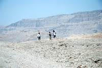
A huge amount of fieldwork is also done on surface sites by various forms of fieldwalking (also called pedestrian survey) which aims to recover and document patterns of material in the surface layers of sites, exposed by processes such as river erosion, deflation and ploughing. This can cover large areas of cultural landscapes and reveal much about changing patterns of settlement concentration and land utilisation in a long-term perspective and link that with natural features and geological processes in the landscape.
Surface survey may also be used to determine the likely information content of a site before it is selected for excavation, for example in response to a threat, in order to utilise resources properly, we need to know in advance whether its worth it, what is there, what kind of information can it yield.
Surface survey however needs to have data, if the data have been selectively and randomly removed by undocumented artefact hunting, no amount of fieldwalking can replace the missing information or correct the distortions of the 'surface signature' of the sites caused by persons unknown removing random items that they find collectable. Macro and microregional studies of settlement patterns, site zonation, and character from surface survey will be rendered impossible if the evidence has been randomly distorted by the activities of tens of thousands of people exploiting the archaeological record as a source of collectable items, which necessarily includes many diagnostic metalwork types. This is the archaeological record. This is the evidence of past landscape use. This is what needs preserving as a resource.


Comments
Post a Comment